


VIOLA Voting District, Lee County, Illinois
About
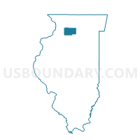
Outline

Summary
| Unique Area Identifier | 572583 |
| Name | VIOLA Voting District |
| County | Lee County |
| State | Illinois |
| Area (square miles) | 35.40 |
| Land Area (square miles) | 35.37 |
| Water Area (square miles) | 0.03 |
| % of Land Area | 99.92 |
| % of Water Area | 0.08 |
| Latitude of the Internal Point | 41.76299830 |
| Longtitude of the Internal Point | -89.10789870 |
Maps


Graphs
Select a template below for downloading or customizing gragh for VIOLA Voting District, Lee County, Illinois


Neighbors
Neighoring Voting District (by Name) Neighboring Voting District on the Map
- ALTO Voting District, Lee County, IL
- BRADFORD Voting District, Lee County, IL
- BROOKLYN 1 Voting District, Lee County, IL
- BROOKLYN 2 Voting District, Lee County, IL
- LEE CENTER Voting District, Lee County, IL
- REYNOLDS Voting District, Lee County, IL
- WILLOW CREEK Voting District, Lee County, IL
Top 10 Neighboring County Subdivision (by Population) Neighboring County Subdivision on the Map
- Brooklyn township, Lee County, IL (793)
- Willow Creek township, Lee County, IL (688)
- Lee Center township, Lee County, IL (593)
- Alto township, Lee County, IL (565)
- Viola township, Lee County, IL (351)
- Bradford township, Lee County, IL (324)
- Reynolds township, Lee County, IL (297)
Top 10 Neighboring Elementary School District (by Population) Neighboring Elementary School District on the Map
- Mendota Community Consolidated School District 289, IL (10,782)
- Steward Elementary School District 220, IL (626)
Top 10 Neighboring Secondary School District (by Population) Neighboring Secondary School District on the Map
- Rochelle Township High School District 212, IL (17,129)
- Mendota Township High School District 280, IL (10,823)
Top 10 Neighboring Unified School District (by Population) Neighboring Unified School District on the Map
- Ashton Community Unit School District 275, IL (3,894)
- Lee Center Community Unit School District 271, IL (1,680)